About 92 minutes
The Thirty Years War — Volume 04 — Themes and Context
Historical Psychological Social Fiction
20,995 recorded words. 10 minutes difference from this book's estimate.
View Gutenberg source #6773
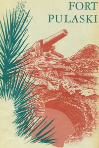
Before opening Fort Pulaski National Monument, Georgia — Edition Insights, the edition data offers a quick orientation: 18,748 words, 1 hr 22 min estimated reading time, and 23 detected text sections.
The text analysis averages about 19.2 words per sentence, while the detected sections provide another way to judge how the source is divided.
Project Gutenberg metadata also associates the work with “Fort Pulaski National Monument (Ga.),” connecting these edition facts with the source record’s subject description.
Explore this collection
These alternatives are selected using recorded categories and estimated reading time.
About 92 minutes
Historical Psychological Social Fiction
20,995 recorded words. 10 minutes difference from this book's estimate.
View Gutenberg source #6773About 94 minutes
Historical Psychological Social Fiction
21,461 recorded words. 12 minutes difference from this book's estimate.
View Gutenberg source #4855About 58 minutes
Historical Psychological Social Fiction
13,223 recorded words. 24 minutes difference from this book's estimate.
View Gutenberg source #55247Search stored excerpts and compare books → Choose by your preferences →
Choices use stored catalog measurements. Estimates vary with reading speed. A shared category is a catalog label, not a claim that two books have the same argument or literary quality.
Search reads excerpt text stored with this catalog and links to its associated Gutenberg record. The connection is stored in the site database; this tool does not recheck that every excerpt is word-for-word identical to that external record. Excerpt search does not cover every chapter and does not verify historical publication dates.
Catalog snapshot checked: 2026-09-26. Coverage: 90 public books, 90 available source excerpts.
Calculated from edition completeness, EPUB availability, text structure and catalogue metadata. Not a user rating.
Total of 100 points, scaled to a 2.5-5.0 range. Editions with an empty description or a missing EPUB file are not scored.
Public-domain source text
The source text is kept in the dedicated reader, separate from this catalogue record and its commentary.
The narrative opens with a sweeping geographical description of the Savannah River, from its origins in the Appalachian Mountains to its sluggish passage through cypress swamps and salt marshes before reaching the sea. This movement from high valleys to tidal flats establishes a recurring pattern in the handbook: the interplay between natural landscape and human military engineering. The fort itself is presented as a product of this environment, built on a low, marshy island that posed constant challenges to construction and defense.
The handbook traces the site's evolution from an undeveloped island, first noted in 1733, to a fortified outpost. Early descriptions emphasize the difficulty of building on the marshy ground, requiring extensive drainage and pile-driving. The narrative moves through the construction phases under different military engineers, noting the slow progress and the eventual completion of the massive five-sided brick structure. The text repeatedly contrasts the ambitious design with the practical obstacles of the location, foreshadowing the fort's later vulnerability.
The bombardment of April 10–11, 1862, is depicted with precise chronological detail, from the opening shots at dawn to the surrender the following afternoon. The account highlights the ineffectiveness of mortar shells against the fort's walls—they "threw up harmless geysers of mud"—while solid shot from rifled cannon caused the whole structure to "quiver and shake." This contrast between weapon types is a central structural device, illustrating the technological shift that made the fort obsolete. The narrative also notes the symbolic act of re-raising the flag under fire, a moment of defiance within the larger story of inevitable defeat.
Beyond the military action, the handbook includes episodes that reveal the human dimensions of the siege. The amputation of a wounded gunner's arm, the single Federal casualty from a solid shot entering an embrasure, and the later imprisonment of Confederate officers in the fort's casemates all serve as focal points. These details are woven into the broader narrative without sentimentality, grounding the strategic analysis in concrete, often grim, realities. The recurring image of the fort's walls being "flaked away" or "laid bare" reinforces the theme of exposure—both physical and tactical.
The handbook shifts fluidly between wide-angle views—the river's course, the regional geography—and close-up observations of damage to specific embrasures or the behavior of individual soldiers. This structural oscillation mirrors the siege itself, where commanders on Tybee Island could see the fort's scars accumulating while inside the walls men struggled with dismounted guns and falling masonry. The final sections, covering the fort's post-war use and its eventual designation as a national monument, bring the narrative full circle, returning to the landscape that first shaped its story.
Readers should pay attention to the way the handbook uses physical details—the depth of a breach, the trajectory of a shot, the condition of a wall—to convey larger strategic and human truths. The text is as much about the relationship between terrain and technology as it is about a single battle. By moving between the general and the specific, it offers a model for understanding how place and event become intertwined in historical memory.
I finished the Fort Pulaski handbook the other evening, and something about those old brick walls staying stubborn against impossible odds stayed with me for days. It reminded me of another quiet journey — Military Roads of the Mississippi Basin — A Reader’s Guide — how paths themselves carry weight long after their purpose fades. That same hush lingers there.
Use these questions to collect your thoughts before moving on.